February 23, 2018

How Drone Real Estate Photography Is Changing the Industry

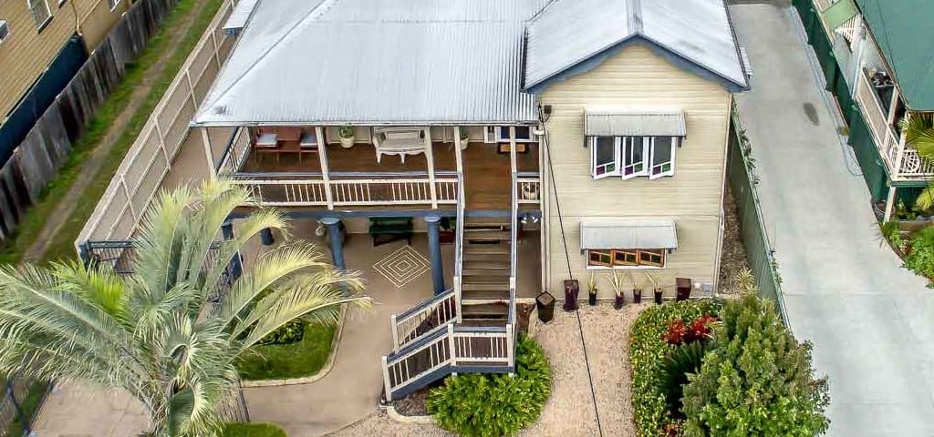
The use of drones is becoming the exciting news of the day, from its use for search and rescues to industrial inspection, agriculture research, and now to drone real estate photography which has helped in creating endless opportunities. Additionally, it is highly recognised that the use of a drone is taking the real estate world of business to another new level, with so many companies taking advantage of this opportunity to produce the best in their real estate business. The Need for Drone Real Estate Photography Wondering how drones are impacting on the real estate through photography? Come on let me breeze you through.  Today, the internet is becoming a favorite place to get interesting information and is certain everyone will want something that looks attractive and unique. And, when it comes to real estate purchase, the best information often starts from new advert made on the internet.  At this point, this is where the use of drone comes to play. As you ought to know, quality drones are prone to offer real estate agent a remarkable and outstanding high-resolution image and video of any property in an efficient and timely manner thereby speeding up their marketing sales. If you […]
August 8, 2017

Filming and Editing Skills for Aerial Video of Real Estate

If you want to film professional-level real estate footage with your drone, you’ll need to master some filming and video editing skills. Here, we’ll go into the details of this so you can get on your way to becoming a pro at filming aerial videos of real estate. Start Slow and Steady The goal of filming real estate is to capture the entire property. Therefore, you should focus on moving your drone slowly during filming to make sure that the viewers will be able to see everything they need to. Make sure not to accelerate or decelerate much, as it will make the footage look choppy and unprofessional. Slow and steady doesn’t just apply to flying your drone either. Do the same when moving your camera, focusing on steady and slow zooms and pans. Views to Capture The next thing to focus on is what views you should get from the sky. Many real estate aerial videos will start from the ground level, showcasing the front of the property and working its way up. Popular shots also include 360 views around the entire property, making sure to get every aspect. Straight above views are common as well and mix up […]
August 6, 2017

Using Drones for Mining Aerial Surveying

Yet another innovative application of drones is using them for mining. They are used in a similar way as they are for aerial surveying and they can save mining companies tons of time and money. Let’s look at this new service a bit closer. What Are Drones Used for in Mining Aerial Surveying? Drones in the mining industry are used for two main things: mapping and mineral exploration. Let’s look at these two areas and see exactly how drones help. Mapping Drones being used for mapping is nothing new and it is a service Droneworxs offers as well. The mapping aspect isn’t really different for mining operations. Most companies want an accurate 3-D map with contour lines so they can measure distances more accurately and drones are the quickest and cheapest way to do it. One thing to note is that mapping is done throughout the entire mining process, not just at the beginning. It is crucial in monitoring volumes of the mine, to determine how much has already been mined out and how much minerals are left. This has been a big innovation because mining companies can get accurate maps every single day if they want to monitor changes […]