The need for Aerial survey drones for surveying process
February 14, 2018The Application of Drones For Industrial Inspection
February 19, 2018Drones are becoming very popular and highly used in almost all the fields of life. Not only that drones are used for military operations and unlawful trespassing, but it also plays a significant role in most of our modern-day activities. A new generation of a more affordable drone is springing up every day and activities carried out with the use of drones by various companies like the drone mapping services, drone video photography indeed provides accurate resolution, automated workflow, and help to save cost and time when utilised. In the past, companies that engage in GIS Mapping services find it difficult while collecting data with the use of a conventional method. But today, with the use of drones for GIS mapping, companies are now able to do things they never imagine.
What Does a Drone Mapping Services Offer?
Drone offers great objective in mapping out a given area. Companies that provide drone mapping services uses three steps process named as Fly, plan, and process. The drones used for this services comes with a powerful feature like post-processing service software application which comes with advanced flight planning and image processing tool capable of taking in a large number of photos and also creating high-resolution maps by collecting data’s which include the captured photos, and videos of the given area. Any new beginner can comfortably operate the software tools equipped with the drones without extensive training. Using this device, you will be able to choose the area that you want to map. When carrying out a drone mapping service, it is mandatory that the flight plan is saved in the computer to avoid repetition of new flight planning.
Benefit of Drone Mapping Services
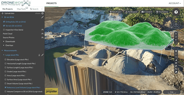
Drones mapping service employ the use drones in mapping out specific sites more comfortably. Since drones used for mapping services is equipped with advanced desktop processing and powerful sensor, Data produced can be easily stored and used for other mapping processes like geological maps, climatic and topographical maps. Images produced by drones mapping service are of high-resolution and can serve a variety of users.
Today, instead of building out complexities and engaging in commonly known mapping services, drone mapping services can be employed to produce high quality and accurate data without having to worry about everything that happens in between.

