Using Drones to Film Aerial Construction Progress
August 1, 2017Best Weather Conditions for Taking Real Estate Drone Photography
August 5, 2017Aerial mapping drones are a technology that is starting to be used more and more because they can do the job quicker and much cheaper than other methods.
The biggest reason is that all the equipment that can be attached to these drones. It makes the process automatic, as the drone can collect all the data with these measuring devices, and then simultaneously send it back to a computer where people can further analyze it.
There are two main methods used in aerial mapping with drones: photogrammetry and LiDAR. Here’s some information about them, and the benefits that using each provides.
LiDAR
Short for Light Detection and Ranging, LiDAR uses lasers to measure distances relative to the ground level. To explain it as easy as possible, it emits laser beams at a set frequency and down to ground level. Once it hits the target being measured, it returns the laser back to the drone. This time difference can then be used to calculate the distance relative to ground level. It may be a little complicated, but that’s how it basically works.
Everything needed for a LiDAR instrument can be attached at the bottom of a drone and then flown over a specified area. This process doesn’t take long and the results are accurate as possible.
Photogrammetry
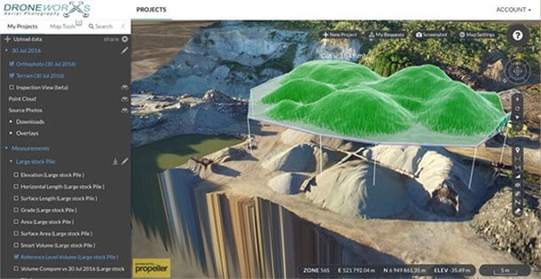
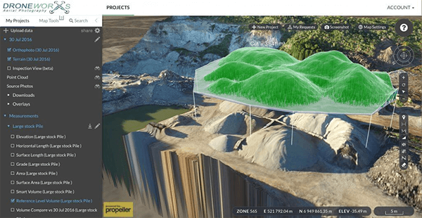
While LiDAR uses lasers to take measurements, photogrammetry uses something nearly all drones are capable of taking: photos. When used with drones, they take photos above and around objects to create 3-D models of them.
Surveyors calculate the specific angles of where they need photographs of, and usually, they take hundreds of photographs. Once the drone captures all of these images, they are uploaded to a computer, where they have software that renders a 3-D model of the structure.
Which Method Is Best?
There are pros and cons of using either. LiDAR can be performed much quicker, only needing a few fly-byes to accurately collect all the data needed. It also can measure through objects such as vegetation, which typical photos can’t see through.
Photogrammetry requires much more thinking by the user, as they have to calculate the best shots needed to develop an accurate 3-D model, which many times can take hundreds of photos.
However, LiDAR is a much more expensive form of technology, while photogrammetry just requires a good drone with a nice 4k camera.
Therefore, they are actually best used together. LiDAR is a more accurate form of data collection in terms of measurements, but its imagery doesn’t provide high-resolution photos. Photogrammetry isn’t as accurate when it comes to measuring distances, but it can capture fine details with photos that laser scanning simply can’t.
That’s why these technologies are best used together. Usually, an aerial mapping drone company will first use photogrammetry to develop a fairly accurate 3-D map of the area. If they want to be more precise, then they can use LiDAR technology to get exact measurements of distances related to each other.
How Drones Have Changed Both
The biggest benefit drones have had is that both of these technologies are now being used on much smaller projects. Before drones, many aerial surveying companies wouldn’t do projects less than 5 square kilometers, as it simply just wasn’t cost effective. Now with drones, even the smallest projects are able to utilize this great technology.
Drones are also much easier to maneuver and get into exact places and hover for a long time. This makes is extremely advantageous when used for photogrammetry, as they can get as close as needed and at specific angles. It’s apparent drones really are changing the way we use aerial mapping, and it will definitely be interesting how this technology progresses in the future.


