Aerial Mapping
September 15, 2017Photography for Real Estate
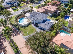
September 15, 2017Drone aerial services in Brisbane are regulated by CASA, an Australian Government body responsible for the operations of Unmanned Aerial Vehicles in Australia. Surveyors, architects, engineers, business owners, and real estate agents seek to make the best use of the benefits that result from the use of drones such as creating marketing clips, documenting construction sites, coming up with high-resolution orthomosaic maps, and improving real estate profile ranks.
Professional drone pilots capture footage that is outstanding: High-resolution photos and videos, large paranomas, and successful independent drone mapping projects.
The Mavic Pro drone is a great choice for capturing High-Def stills and shooting 4K videos owing to it being lightweight and can maneuver easily. Whether cityscape, landscape, or outdoor photography, drones offer the best aerial footage for construction projects, realty development, branding for corporates, and holiday business ventures in Brisbane.

Drone paranoma shooting allows for capturing of an array of aerial photos and then come up with a large merged image perfect for big prints.
Independent flight control apps such as Skyward and DroneDeploy facilitate aerial drone mapping, allowing for the capture of high-resolution aerial images. Clients are provided with quality multi-format GIS data allowing for more visualization, a deeper analysis, and an accurate interpretation at the smallest time possible and at a lower cost compared to traditionally manned flights.
You can now get accurate and properly detailed geo-referenced maps using UAVs with high-resolution cameras, flying at somewhat low altitudes ranging between 164 to 246 feet.
The greatest beneficiaries of aerial drone services in Brisbane are surveyors, builders, engineers, developers, and construction industries.
Geospatial drone mapping in Brisbane is utilized in different industries for processes such as:
- Volumetric measurement for cumulative cut and fill zones.
- Identification of features in landscapes and terrains.
- Conducting Surveys and mapping before the start of a construction.
- Generating mesh maps of already established buildings and structures.
- Keeping construction and development records in the long run.
The use of UAVs reduces the risk posed to humans on any site whether mining, construction, or infrastructure management, eliminating interruptions and enhancing productivity. Drones can be set up real quick, can be deployed easily, have minimal interferences to the immediate environment, fly below the cloud cover, and are much safer compared to manned aircrafts. The carbon print produced by drones is quite minimal compared to controlled vehicles and aircrafts.
Telecommunication companies In Brisbane can make use of UAVs to inspect power poles and communication towers to ensure all is well and that subscribed clients have no power and service interferences whatsoever. UAV aerial surveys allow for:
- Thermal image inspections.
- RF exterior interruption detection.
- Line of sight surveys to facilitate transmission.
- Making maintenance inspections of structure and design upgrades, as well as 3D modeling and asset management.
Brisbane’s infrastructure maintenance and management are of great importance. Aerial surveying using drones allows for:
- Road and bridge inspections.
- HV tower and power line inspections.
- Dam wall inspections.
- Lighting pole repair inspection.
- Wind turbine inspections.
- Pumping and pipeline equipment inspection.
- Environmental, physical, and energy efficiency building inspections.
- Construction routine maintenance inspection.
Mines in Brisbane can be scanned on a daily basis via drones to enhance productivity. Activities that can be conducted include:
- Stockpile measurement.
- Assessing site safety.
- Tracking production progress.
- Monitoring the environment.
Construction sites in Brisbane can have their operations optimized using drones which are able to capture aerial data with exceptional quality, create a detailed analysis, and generate the site’s 3D survey. Through drones you can be able to:
- Monitor edgy slopes and discover break lines.
- Compare building plans and the actual build.
- Monitor the building supplies stockpile volumes.
- Create a time-lapse photography of the construction taking place.
Regardless of your business needs in Brisbane, you are assured of access to end-to-end UAV aerial solutions from the planning of fights, to capturing images, to processing and accurately analyzing the collected data. With CASA publishing the drone flight rules and regulations, flying one in Brisbane is no longer a limited idea. Simply get drone, get a license, and hit the skies. The possibilities are endless.
