

Brisbane’s Leading Drone Aerial Photography Services
Why choose us as your drone Aerial photography providers?
By utilising the latest technology and most sophisticated aircraft and camera systems, we deliver the highest quality and best value Drone aerial photography services available in Australia. Our specially designed Drones are capable of flying at altitudes of up to 120 meters (400 feet). We are able to get very close to the action, unlike helicopters or fixed wing aircraft. Our professional drones is specially designed to capture the perfect shot or video, and we can capture the highest resolution still and motion video images to meet all of your aerial photography and cinematography needs. Our latest Drones incorporate Real Time Kinematics (RTK) which is perfect for aerial survey inspections. We are CASA certified and fully insured, and we’re ready to work with you to ensure you’re 100% satisfied with the outcome.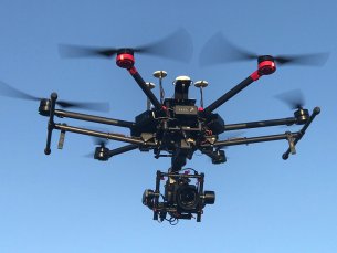
Droneworxs Image Resolution Just Got Better
Not all drone operators are the same when it comes to the service they provide, while they may take photos not all photos are the same.
Read more here about our quality cameraFrom drone aerial inspection services to mine surveying and much more
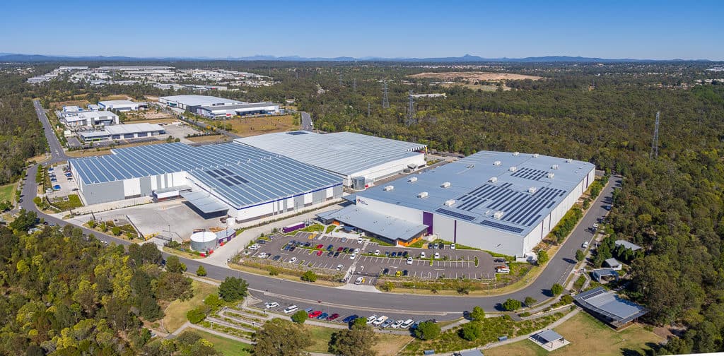
- Real Estate
- Asset Inspections
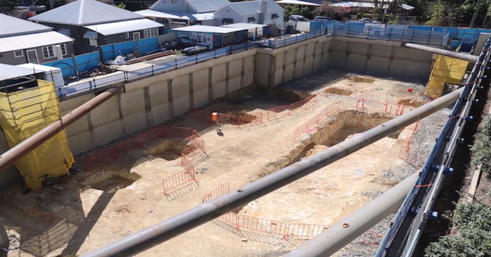
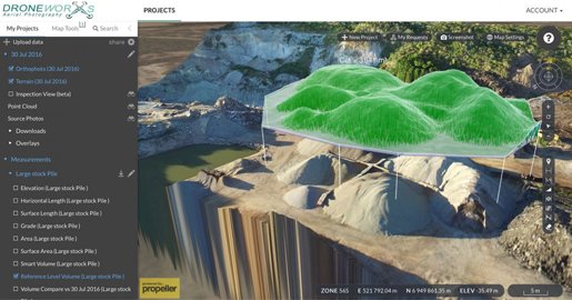
- Mapping and Surveying
- Mining Oil and Gas
- Insurance Inspection
- Construction Time Lapse
Our Featured Works
The proof is in the pudding, and without further ado, here is our pudding! A collection of some works we've shot through our media wing.
Some Fun Facts
Hours flown
Distance Flown KM
Cups of Coffee
Let's Chat
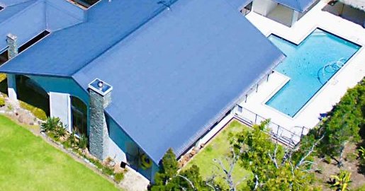
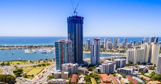
Real estate photography and real estate video are critical to the success of any marketing campaign. Real estate aerial photography gives the opportunity to better showcase a property, thereby maximising its value to the potential buyer.
Drones or a UAV have many purposes but their aerial view is especially useful for creating aerial photos and video that enable the buyer to gain the widest possible perspective on a property and its surrounds.
Aerial photography is not a new thing, previously relying on manned aircraft, which often proved cost prohibitive. An aerial photography drone provides a cost-effective, affordable solution, ensuring maximum return on investment.
Though drone photography is not a new thing globally, in Australia drones have been employed for that primary purpose relatively recently. Quality aerial drone photography not only relies on a skilled pilot, but also a talented real estate photographer. We offer both!
Our latest state-of-the-art Quad Copter photography drone offers the highest level of stability in Australia, creating a wide selection of hot shots for the perfect aerial photo!
In the area of aerial photography Brisbane and Gold Coast is a market of fast growing needs. We provide practical and flexible options to suit those needs, not only meeting your expectations, but exceeding them!
We are an organisation committed to a quality finished product with a professional level of service to ensure that any requirement you have is achieved to the highest of standards.
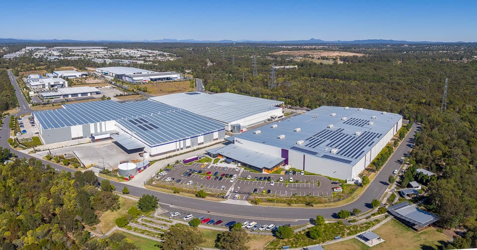
The use of an aerial drone extends to other areas as well. Our drone services include, and extend to:
- Drone Aerial Photography
- Create the quintessential campaign for commercial and residential real estate property. Showcase not only the property, but also importantly the immediate neighbourhood, location & facilities. This enables prospective buyers to gain a better perspective of the proposition, saving your staff time by answering some critical questions prior to enquiry.
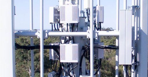
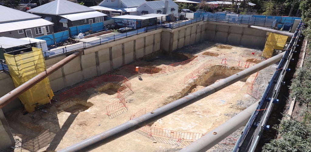
- Drone Asset Inspection
- Reduce the cost of asset inspection by removing the need for scaffolding or cherry-pickers, and conduct quick and efficient inspections
- Roof Inspection Aerial
- A safe and time-efficient alternative to scaling roofing, hiring specialist organisations for inspection purposes
Terms used by CASA (Civil Aviation Safety Authority) for drones:
UAV – Unmanned Aerial Vehicle
UAS – Unmanned Aircraft System
RPA – Remotely Piloted Aircraft
RPAS – Remotely Piloted Aircraft Systems
RPL – Recreational Pilot Licence
UOC – UAV Operator Certificate
ReOC – RPA operator’s Certificate
RePL – Remote Pilot Licence
The UAV Australia industry is governed by CASA, and recommended that any paid RPA commercial work is completed by a certified ReOC operator.