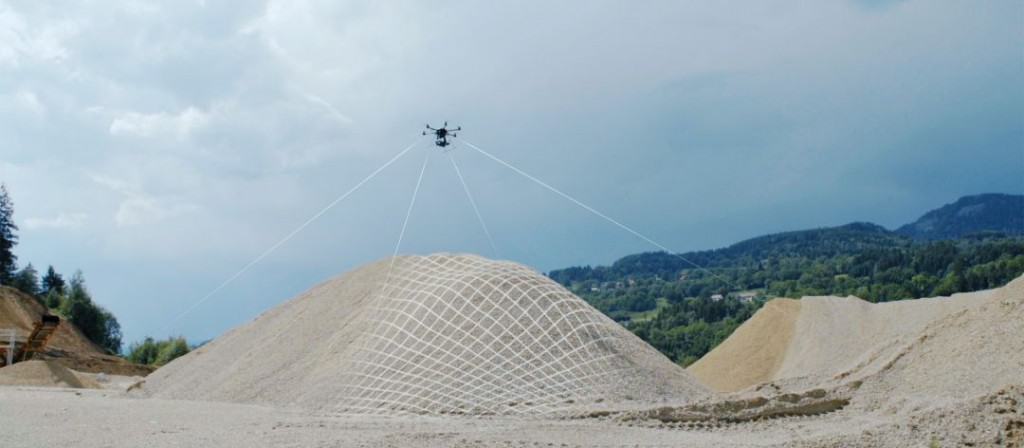
Drone Aerial Mapping
Drone Aerial Mapping from Droneworxs Aerial Photography can deliver a diverse range of services to many of Australia’s major mining resources companies. Our Remote Piloted Aircraft (Done) are seen as an perfect tool for mine surveying, we can generally operate from the perimeter of busy, working pits. It is also safer, faster and more cost effective. Drones provide the ability to capture on-demand maps for a fraction of the cost of traditional approaches using manned aircraft, and at a much higher resolution than satellites. Unlike satellite data we operate on an on-demand basis, and our drones fly quite low and so aren’t affected by cloud. The resolution of our maps is usually 3cm per pixel (3cm GSD), which is enough to see a golf ball or matchbox, and if required we can provide higher resolutions. We can also process the data to deliver full 3D terrain models (e.g. DSM, DTM) and the accuracy of the 3D data is generally around 5cm laterally and 5-8cm vertical. These outputs are fully geo-referenced and ortho-rectified, meaning measurements and calculations can be taken directly from them. This can be anything from basic distance, area and slope calculations right up to stockpile volume analysis, sight lines or watershed runoff simulations using our specialised portal. In an increasingly digitised world, our drones provide the ability to easily and accurately capture your site to gain all the benefits of computer modelling and analysis for planning or monitoring your projects.
The Advantages of Droneworxs Surveying services for the Mining Industry
Mining firms in Australia have been taking advantage of the many benefits of drones for some time now, in fact, and use of the technology is set to increase in coming years. The main application of UAVs in a mining context is for the all-important task of site scoping and mapping. Obtaining a comprehensive and accurate bird’s-eye view of a mining site has always presented a challenge, but drones have recently risen to prominence as a viable, long-term solution. Using drones to carry out mapping work is in many ways the most logical option, when you consider the numerous benefits this technology brings.
Improved Safety
Safety is paramount in any mining site, and traditional scoping efforts have often put human lives at risk. With their ability to generate an accurate, 360-degree view of an area from all angles, UAVs effectively take this risk out of the equation. Mining operations around the world have already demonstrated how drones can be deployed to quickly assess a mine and identify any existing or potential hazards, such as areas that could cave in. The use of UAVs will be especially pertinent to certain branches of the mining and resources sector, for example in floating LNG, where the constant monitoring of offshore plants continues to be a challenge. As UAVs, by definition, are unmanned by a human pilot, it also eliminates the need for personnel to be operating aircraft and putting their safety at risk.
Boosting Productivity
In addition to saving lives, UAVs can also save substantial time for mining firms and boost their operational efficiency. UAVs have the ability to scan an area and produce a 3D map much more quickly than traditional mapping methods, at a fraction of the cost. With a limited number of staff required to operate and oversee these vehicles, human resources can be directed to more pressing needs. Dealing with downtime when surveying and assessing mining sites has also been a costly problem, but drones’ ability to efficiently scope a site’s infrastructure – without having to shut down the plant – means vital hours can be saved.
More Reliable
Mining UAVs use the latest in 3D mapping technology to generate accurate overviews of any conceivable terrain. High-resolution images can be instantly generated, allowing operators to get to work instantly. Many machines come equipped with state-of-the-art software to allow miners to carry out extensive assessment and planning on the maps produced.
Cost-effective
One of the strongest cases for using UAVs in mining is that it is simply a more cost-effective method than traditional approaches. Drones are cheaper to operate than manned aircraft, which entail a number of running and maintenance costs. Although there are associated ongoing costs, the bulk of the expenses involved with owning and operating a drone lies in the initial procurement.
Other factors
Flexibility – The UAV technology can be applied to a number of surveying projects. Scale – UAV technology is well suited to large scale projects due to its ability to cover large areas in a relatively short time compared to traditional survey techniques. Safety – UAV is a fantastic technology for surveying inaccessible, dangerous areas remotely and autonomously.
- Safer (no more people walking the mine)
- 100% Electric powered craft
- Minimise risk Fast Response – Quick and easily deployment compared to deployment of a fixed wing aero plane.
Turnaround – DEM and orthophotography in hours or days, not weeks. Imagery – A key benefit of a UAV solution is the provision of high resolution digital imagery as well as highly accurate survey data.No disruption to operations.
UAV technology has a variety of applications including;
Topographic survey Infrastructure Mapping Waste Management Disaster Management Stockpile Surveys Asset Management Vegetation monitoring Safety Assessment Stockpile Calculations Open Cut Pit Volumes
Droneworxs are able to provide better, more accurate data than full size aircraft because we fly slower and lower.

