Why You Should Use Drones for Real Estate Photography
December 6, 2017
Drone Photography Brisbane: Rules and Conditions of Operation
December 8, 2017Once upon a time, drones used to be just that remote-controlled aircraft that didn’t have much use or relevance. However, times have changed, and tides have turned.
This simple but effective aerial vehicle has fought its way to reckoning. For some, especially those who do not know it’s worth or how drones can be deployed and employed, drones are luxuries. However, to a more significant number of people, especially those who have applied it in photography or aerial mapping, it is a necessity.
Imagine a photographer or cameraman who is entrusted with the task of viewing an object from a very tall height. That’s a huge task, isn’t it? Not to worry because, with drones, you wouldn’t have to break a sweat.
Drone and its increasing use of aerial mapping
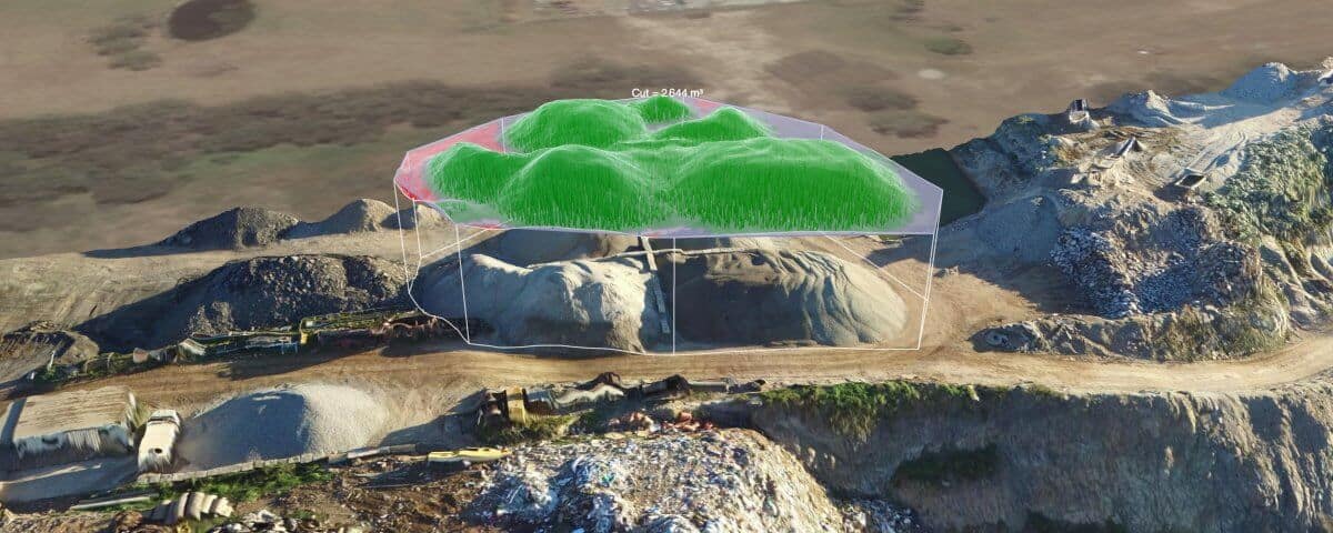
Aerial mapping is just another name for surveying. As explained earlier, drones help us to cover a distance that would ordinarily be more difficult without them.
They help us to reach a trajectory we wouldn’t have been able to reach and most importantly, they also help us to appreciate the beauty of nature more and more. However, despite the superlatives, not all drones are suitable for this purpose.
Just as human beings are different in shapes, sizes, color, and physique, so do drones vary in sizes, color, design, and ability. All these factors determine their functionality and what they can be used for.
Anyone who has seen surveyors till the earth and works with their conventional and traditional method would agree that it is not an easy assignment to embark upon. However, statistics have shown that a mastery of the control and operation of drones makes this process easier by about 60%.
Another advantage of using drones for aerial mapping is that it helps to cut cost and save money. Ideally, it should take several hours and manpower that would demand reasonably modest service fee to carry out this exercise.
However, with drones, you would not have to worry much about the high cost associated with the aerial mapping. Companies that use drones can testify more about its cost-saving potential.
Drones and safety
From ages past, aerial mapping has always been a life-threatening and challenging job. In fact, many have lost their lives, and many more lives will be lost if drone technology isn’t well received. Thankfully, the emergence of drones has helped reduce the risk associated with this job. Drones now cover heights that a human being would have covered with well-positioned cameras, and all of a sudden, interest in aerial mapping is experiencing a steady increase again.
All in all, the emergence of drones and its overall ability to enhance the rate of aerial mapping and photography is a further confirmation of the fact that technology is gradually taking over the world, human lives, and the way things are done. Drones aren’t just machines, and they are super-machines. They are useful, proven, cost-effective, and a much more improved way of doing the aerial mapping.

