February 16, 2018

Things You Need To Know About Drone Mapping Services

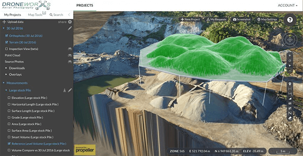
Drones are becoming very popular and highly used in almost all the fields of life. Not only that drones are used for military operations and unlawful trespassing, but it also plays a significant role in most of our modern-day activities. A new generation of a more affordable drone is springing up every day and activities carried out with the use of drones by various companies like the drone mapping services, drone video photography indeed provides accurate resolution, automated workflow, and help to save cost and time when utilised. In the past, companies that engage in GIS Mapping services find it difficult while collecting data with the use of a conventional method. But today, with the use of drones for GIS mapping, companies are now able to do things they never imagine. What Does a Drone Mapping Services Offer? Drone offers great objective in mapping out a given area. Companies that provide drone mapping services uses three steps process named as Fly, plan, and process. The drones used for this services comes with a powerful feature like post-processing service software application which comes with advanced flight planning and image processing tool capable of taking in a large number of photos and […]
February 14, 2018

The need for Aerial survey drones for surveying process

In our world today, Drone technology is advancing at a rapid stage. And Depending on certain functions, specific types of drones used for different purposes like the Aerial Survey drones, mapping drones, and agricultural drones is introduced into the market almost every day. With this drones highly equipped with numerous amazing features such as mobile apps and software applications that allow users to easily control their various function and specific tools that make it more exciting and highly productive. Using these drones comes with so many benefits that one can never imagine, because when used either for mapping, inspection, photography and so much more, it helps get the job done faster and promptly. Searching the internet for drones, you might have come across thousands of lovely pictures of homes and aerial view of an area. These are some significant advantages of using an aerial survey drone. Follow me in these articles as I unveil to you important things you need to know about an Aerial Survey drones. But before we move on is best you know more about aerial surveying. What You Need To Know About Aerial Surveying Aerial Surveying is highly essential when carrying out essential activities like mapping, […]
February 12, 2018

The Application of Drones for Pipeline Inspection

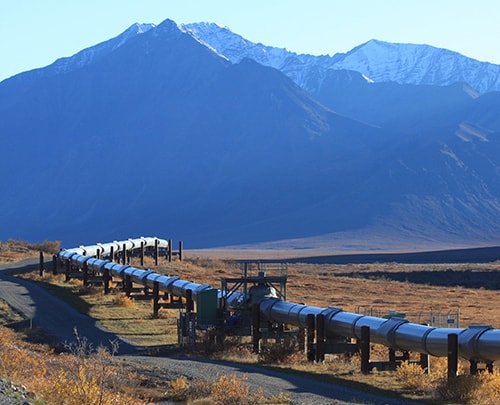
In our world today, Pipeline companies are highly faced with ever-increasing regulatory and operating pressures. The increase in government regulation on pipelines has resulted into the springing up of several technological innovations like the use of drones for pipeline inspection , Remote video , and remote NDT pipeline inspection, all these to make inspection on pipeline faster and easier. Since pipeline operators need access to analyse signs of metallic loss, corrosion on pipes and other defects to efficiently detect the problems and ensure safety, new regulations are proposed or introduced each year that require mapping, facility inventories, pipe inspections, environmental reporting, and public safety. What You Need To Know About Pipeline Inspection Pipeline Inspection- This is commonly known as a technique used in checking the functionality of natural gas transmission pipelines either from the inside or outside of the engineering pipe or pipe plants. Since pipeline are popularly used in transporting energy like gas in a long distance, it is essential to carry out frequent inspection and maintenance otherwise; pipes are prone to failure. And failures on pipelines can lead to a dangerous effect on any plant or human around the place of occurrence. Why inspection should be carried out […]